
Antler Creek
The Legandary Antler Creek was discovered by miner John Rose in 1860, who named the creek after the piles of cast off antlers from caribou herds that passed through the area seasonally. Gold was discovered on bedrock just down from a spot now known as "Saw Mill Flats", John Rose and others were reported to have had difficulties figuring out how to mine the ground, "for all we saw in every direction was gold". Antler creek would see the camp at Antlertown spring into being but it did not last long. The pay layer continued below the town, so it was burned down and not rebuilt. Mining activities on Antler creek continued off and on into the present day, with at least two active mining crews working seasonally. It is not offically known how many ounces of gold have been recovered from Antler Creek but some estimate that at least 5 million ounces were recovered over the decades.

Amos Bowman Map - Antler Creek. See the store to purchase!

A nugget from Antler Creek!

Looking out over Antler Creek from the forest


Robert Robinsons ground on old Summit Creek, lower Antler Creek

Robert Robinsons ground on old Summit Creek, lower Antler Creek

Remains of a ground sluice, in total around 20 meters long.

Remains of a ground sluice, in total around 20 meters long.

This was where an addit was located before it was caved in by unknowing miners.

A flooded and collapsed addit, driven to find the lost channel.

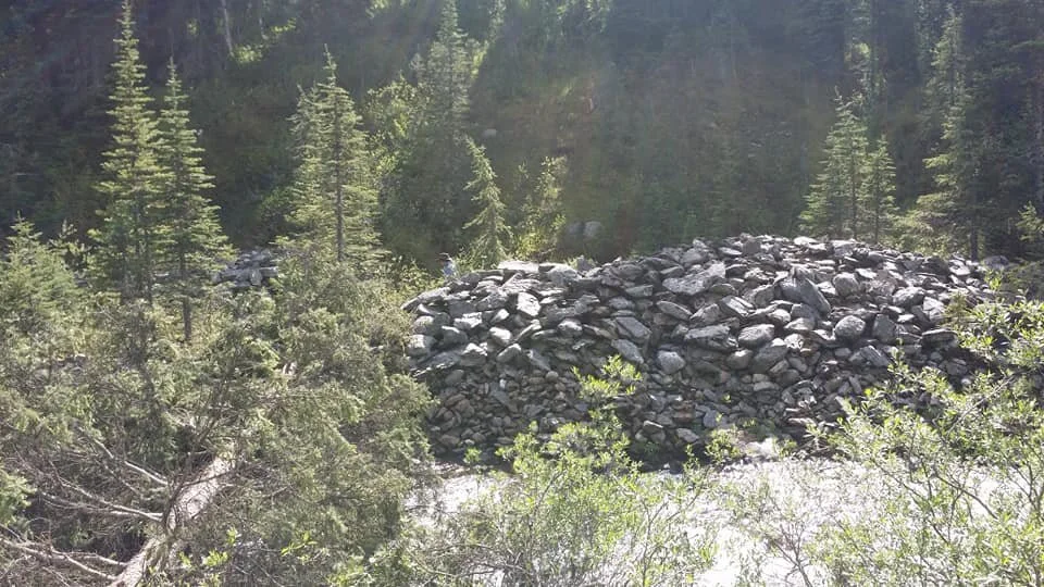
Century and a half old rock piles above sawmill flats.
Massive rock walls next to the creek


A ground sluice hole from the 1930s

Amazing how well the piles were stacked.

Ruins of an 1800s mineshaft on Antler Creek below Eureka Gulch. On the bottom right is the original windless laying where it fell 150 years ago

Exploring the highest reaches of Antler Creek.

Wandering Antler Creek, October 2018